
2015 Workshop Photo Contest
CEDAR Physics in Action
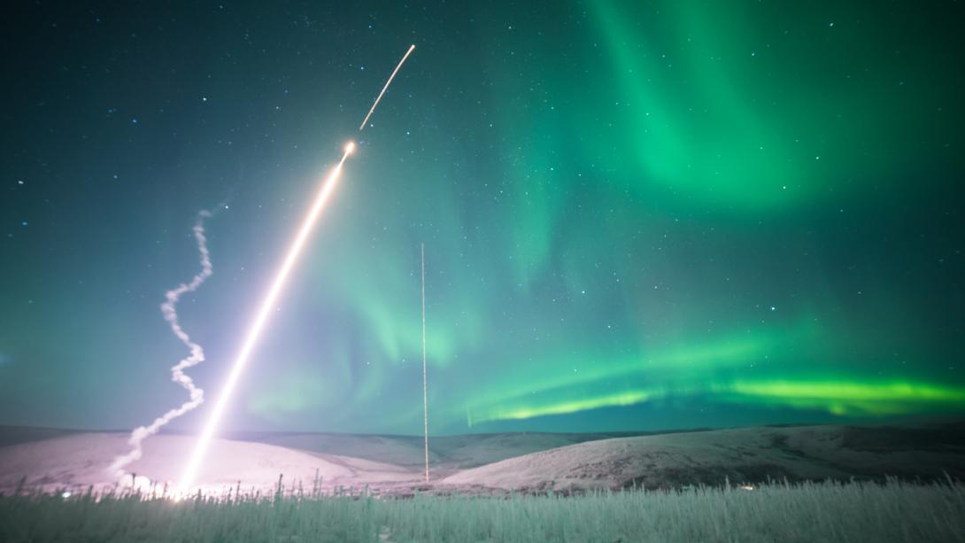
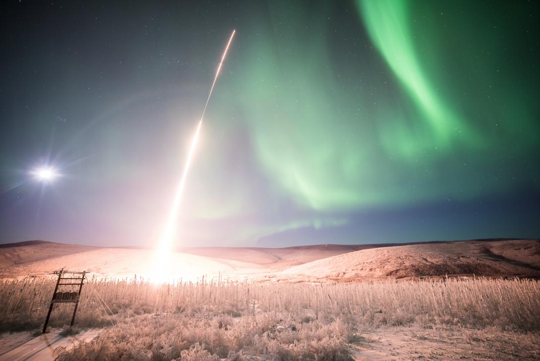
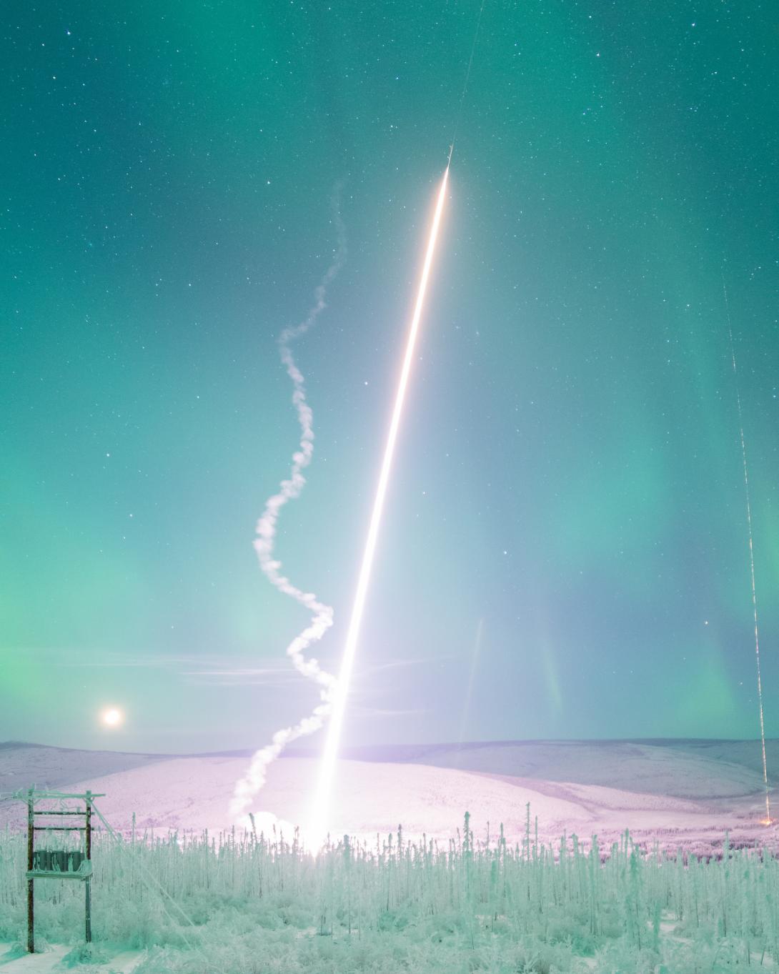
(2015 Photo Contest Winner) Miguel Larsen's MIST launch and the smoke trail from Richard Collins' MTeX launch from Poker Flat. Photo taken by Jason Ahrns.
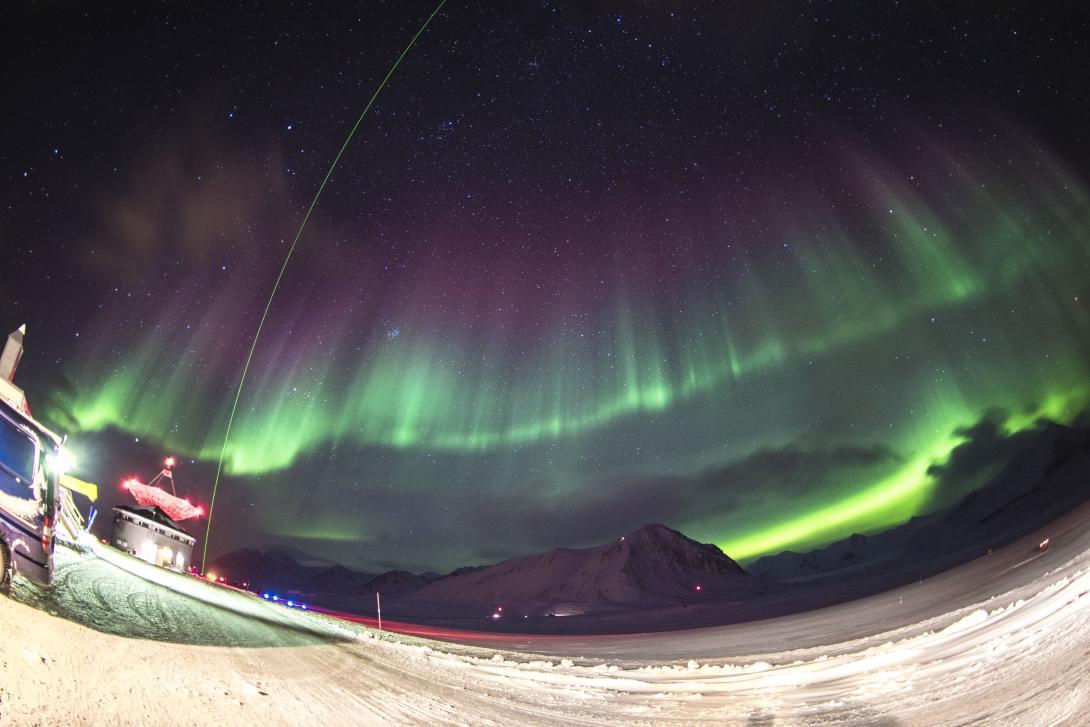
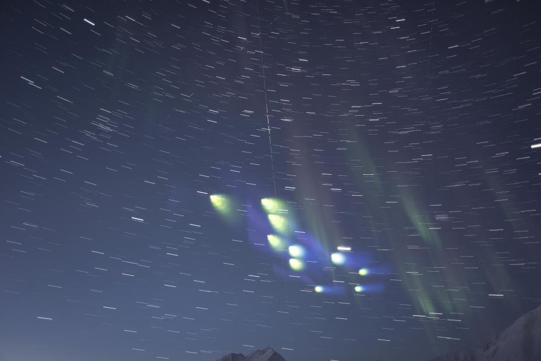
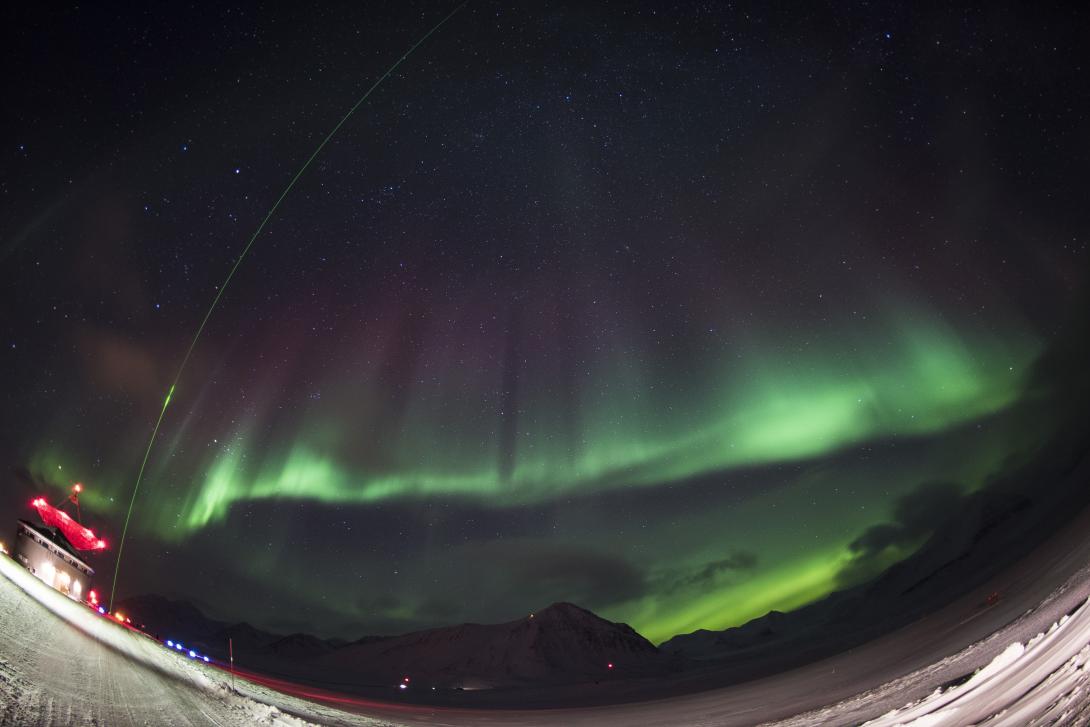
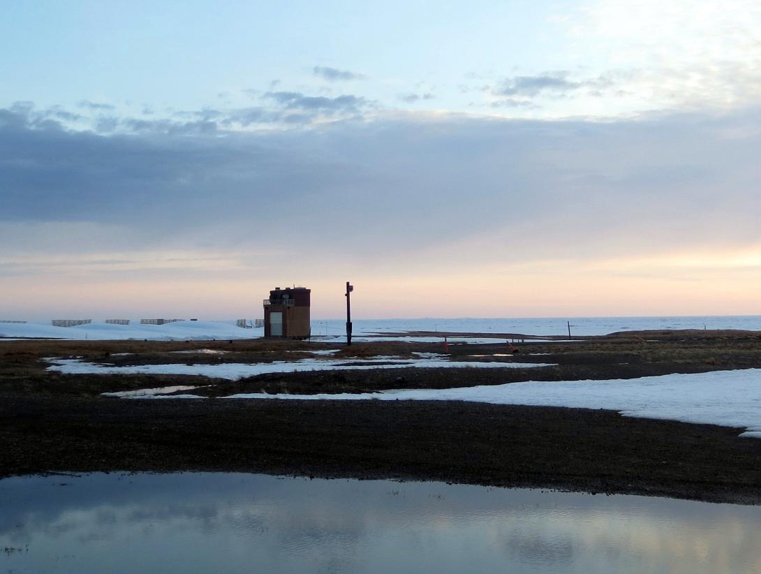
(2015 Photo Contest Honorable Mention) Taken 15 Nov 2014 by Manbharat Singh Dhadly at Ny-Alesund (world's northernmost village), during the C-REX rocket mission. LIDAR with aurora.
(2015 Photo Contest Honorable Mention) Sprite image taken by Jason Ahrns during the Hans Nielsen/Geoff McHarg's 2011 sprite campaign.
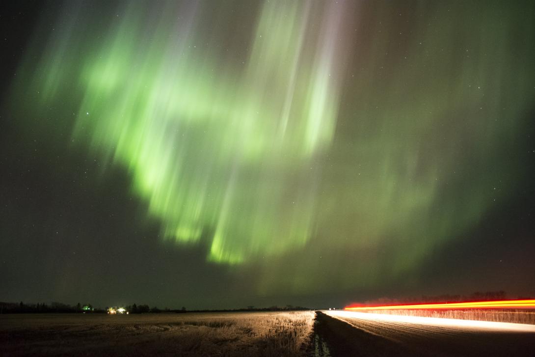
The photo was taken on April 10th, 2015 at 5:53 UTC (April 9th, 2015 at 23:53 Saskatchewan Time) by Ashton Reimer. The location that the photo was taken is approximately 10km south-east of Saskatoon, Saskatchewan at 52.056546N and 106.438017W. The photo was taken looking East (time lapse: https://youtu.be/1x_HYdW9mw4).
A long exposure of weather balloons going up during a launch window at Poker Flat. Photo taken by Jason Ahrns.
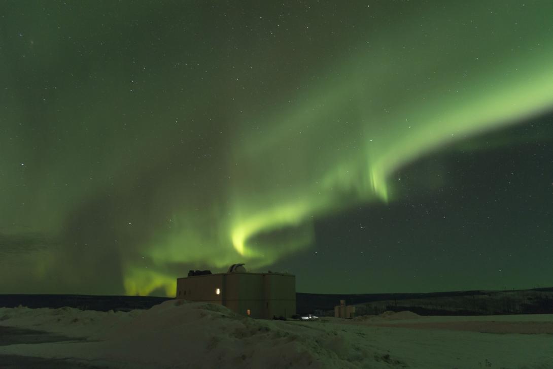
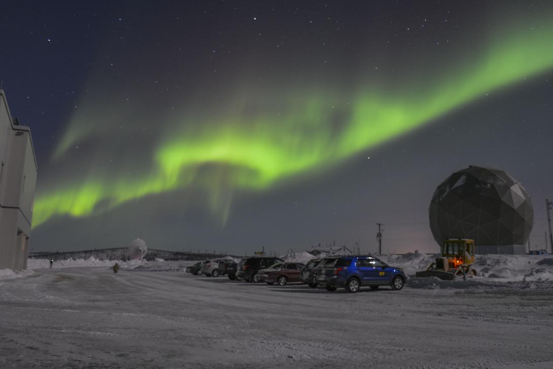
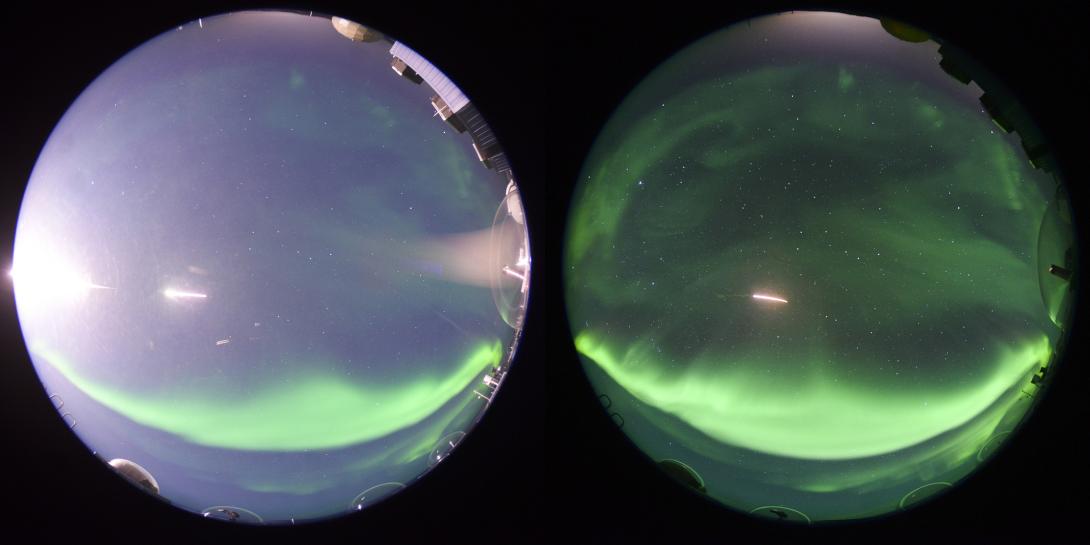
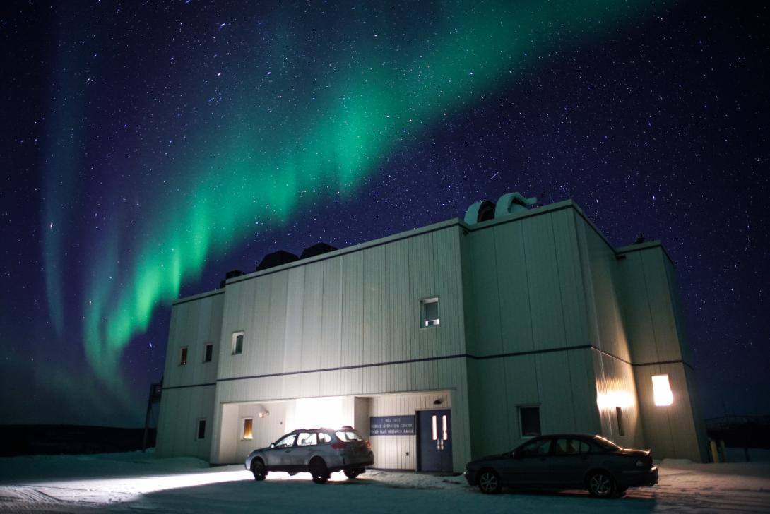
The Poker Flat Science Operation Center under diffuse and discrete aurora. Photo taken 29 Jan 2014 by Manbharat Singh Dhadly.
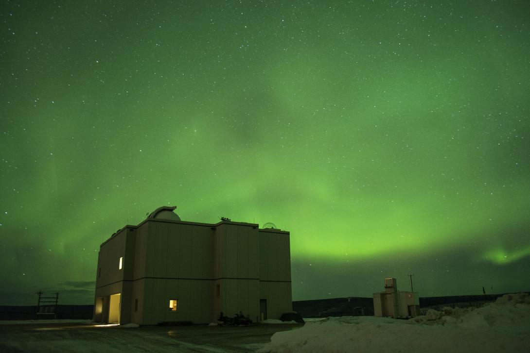
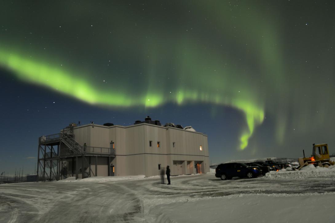
The Poker Flat Science Operation Center under diffuse aurora. Photo taken 29 Jan 2014 by Manbharat Singh Dhadly.

Discrete aurora over Poker Flat (Alaska). Photo taken 07 Feb 2014 by Manbharat Singh Dhadly.
The Poker Flat Science Operation Center under diffuse aurora. Photo taken 29 Jan 2014 by Manbharat Singh Dhadly.
Diffuse aurora with boundary seen on 29 Jan 2014 at the Poker Flat Science Operation Center (Alaska). Photo taken by Manbharat Singh Dhadly.
Discrete aurora over Poker Flat (Alaska). Photo taken 07 Feb 2014 by Manbharat Singh Dhadly.
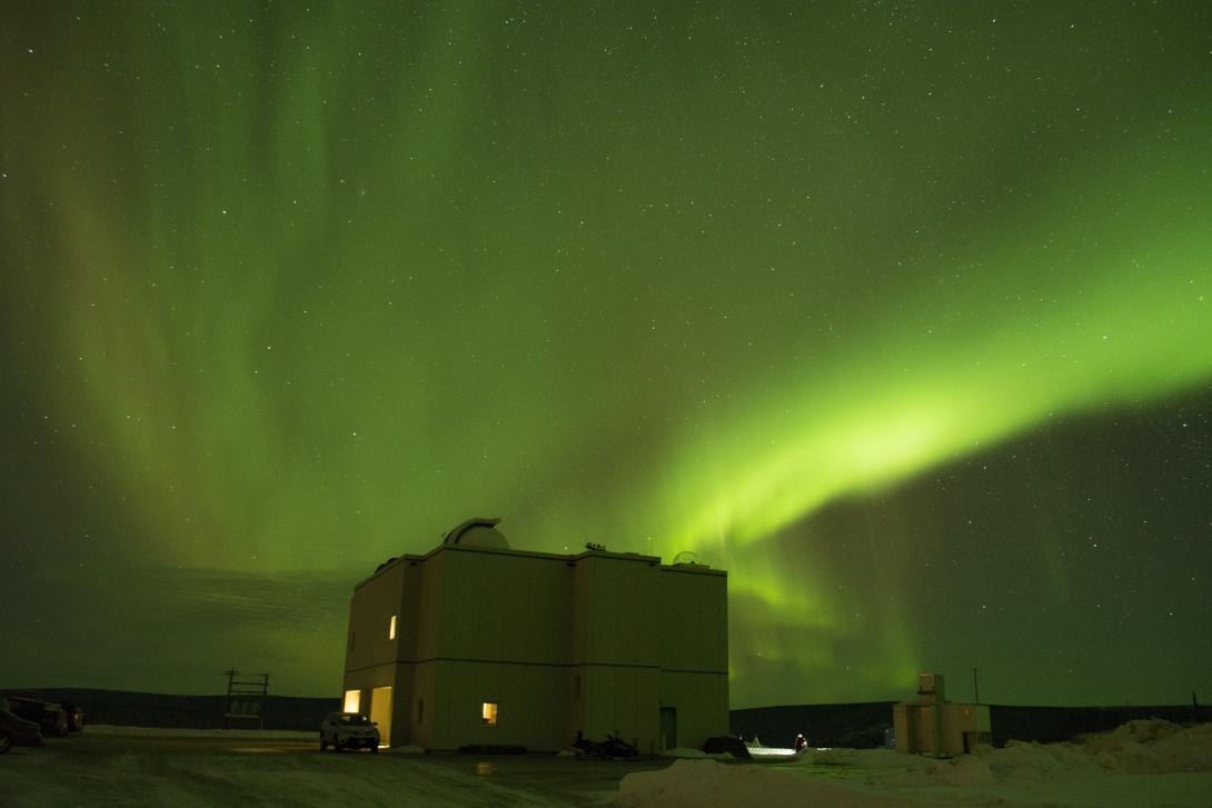
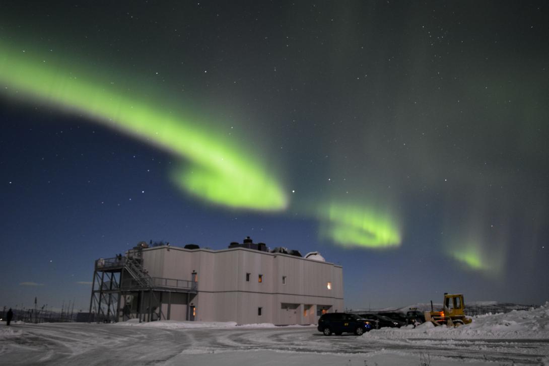
The Poker Flat Science Operation Center under discrete auroral arc. Photo taken 07 Feb 2014 by Manbharat Singh Dhadly.
The Poker Flat Science Operation Center under interesting small scale auroral structures. Photo taken 07 Feb 2014 by Manbharat Singh Dhadly.
Jets above Dorian over the central east coast of Florida on 3 August 2013. Photo taken by Ningyu Liu.
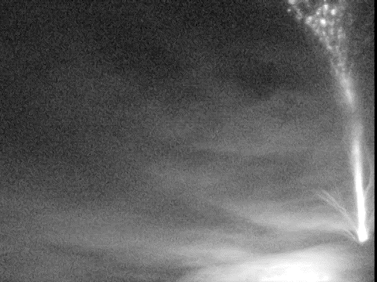
Jets above Dorian over the central east coast of Florida on 3 August 2013. Photo taken by Ningyu Liu.
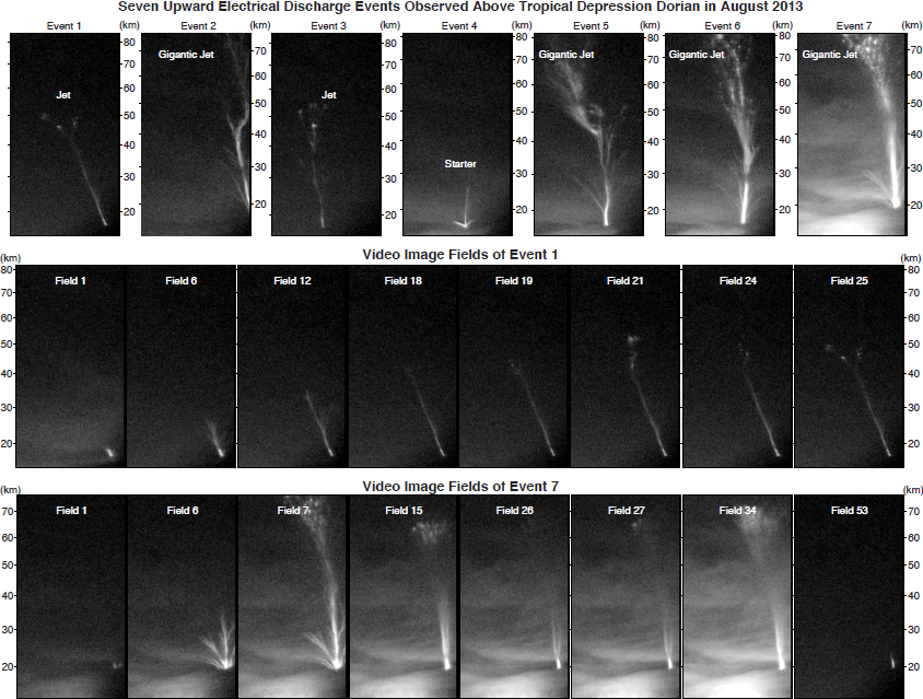
Jets above Dorian over the central east coast of Florida on 3 August 2013. Photo taken by Ningyu Liu.
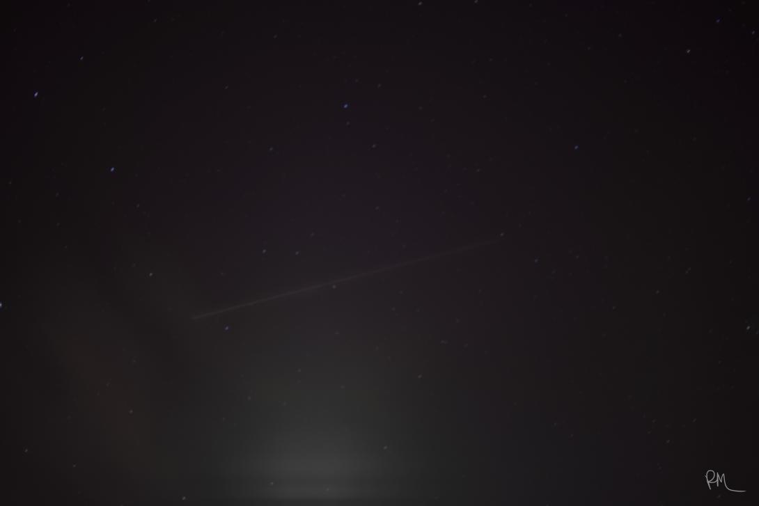
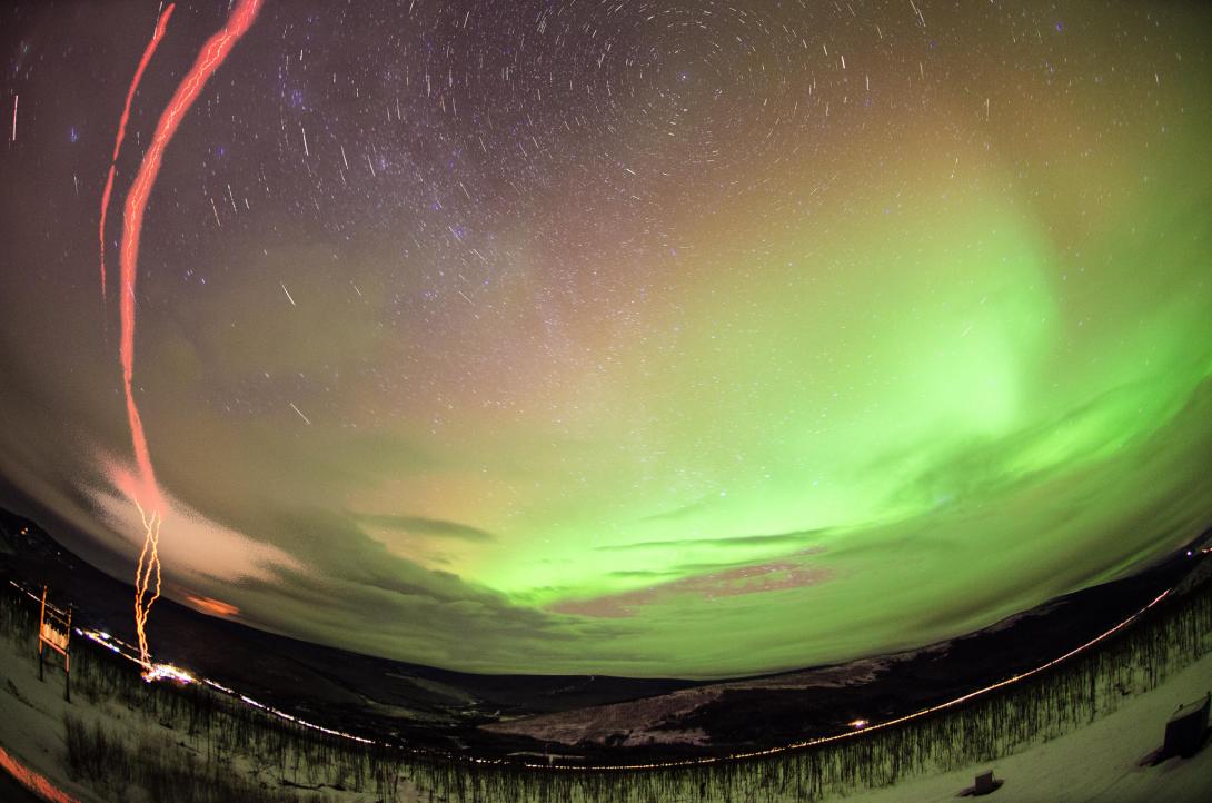
"The photograph was taken from my porch in Clemson/SC at 10pm 2/14/2015, while I was trying a 630-nm filter in my DSLR with long exposures. I got lucky and after I took some red pictures, I removed the filter and caught that. As the name of the picture suggests, it's a meteor trail." - Rafael Mesquita
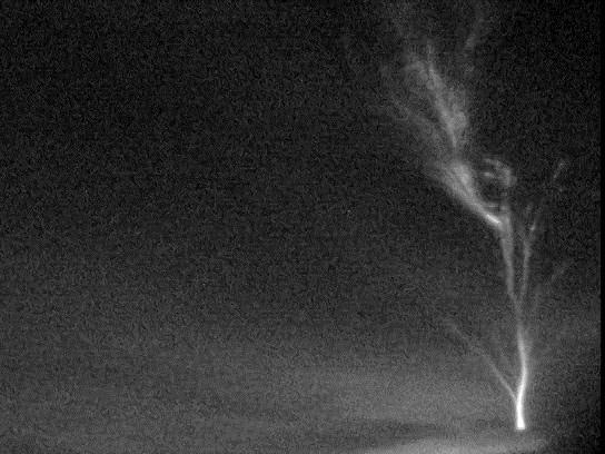
A false color image of a negative sprite. This event was recorded above a tropical storm over the central east coast of Florida on 12 September 2014. Taken by Ningyu Liu.
Taken 24 Nov 2014 by Manbharat Singh Dhadly at Ny-Alesund (world's northernmost village), during the C-REX rocket mission. Visual example of ion-neutral dynamics in upper thermosphere and cusp region.
Taken 15 Nov 2014 by Manbharat Singh Dhadly at Ny-Alesund (world's northernmost village), during the C-REX rocket mission. LIDAR laser light scattering by clouds with aurora.
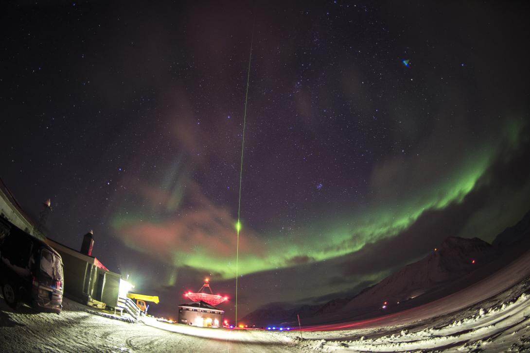
Taken 15 Nov 2014 by Manbharat Singh Dhadly at Ny-Alesund (world's northernmost village), during the C-REX rocket mission. LIDAR laser light scattering by clouds with aurora.
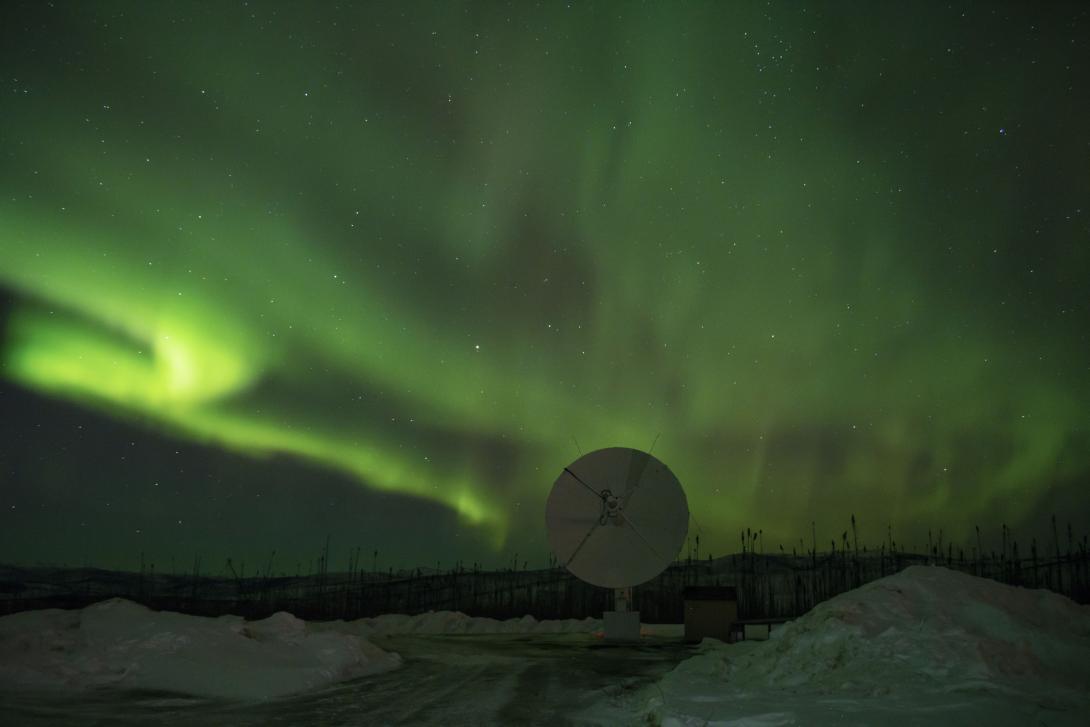
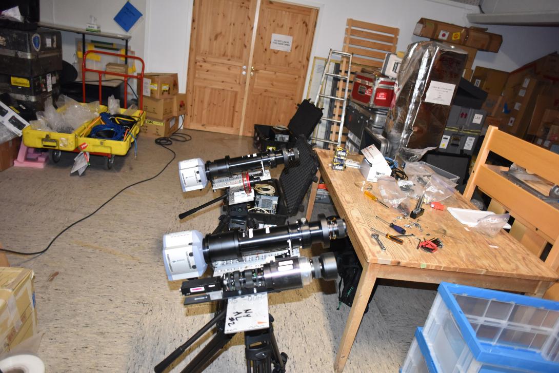
Taken 15 Nov 2014 by Manbharat Singh Dhadly at Ny-Alesund (world's northernmost village), during the C-REX rocket mission. Two LIDARs in action.
Charles Swenson's ASSP launch from Poker Flat. Photo taken by Jason Ahrns.
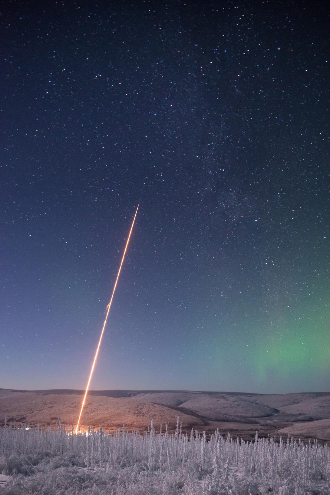
A MTeX/MIST rocket. Photo taken by Jason Ahrns.
A small test rocket during the MTeX/MIST and ASSP campaign windows. Photo taken by Jason Ahrns.
Two consecutive exposures of Marilia Samara's GREECE launch at Poker Flat. Photo taken by Jason Ahrns.
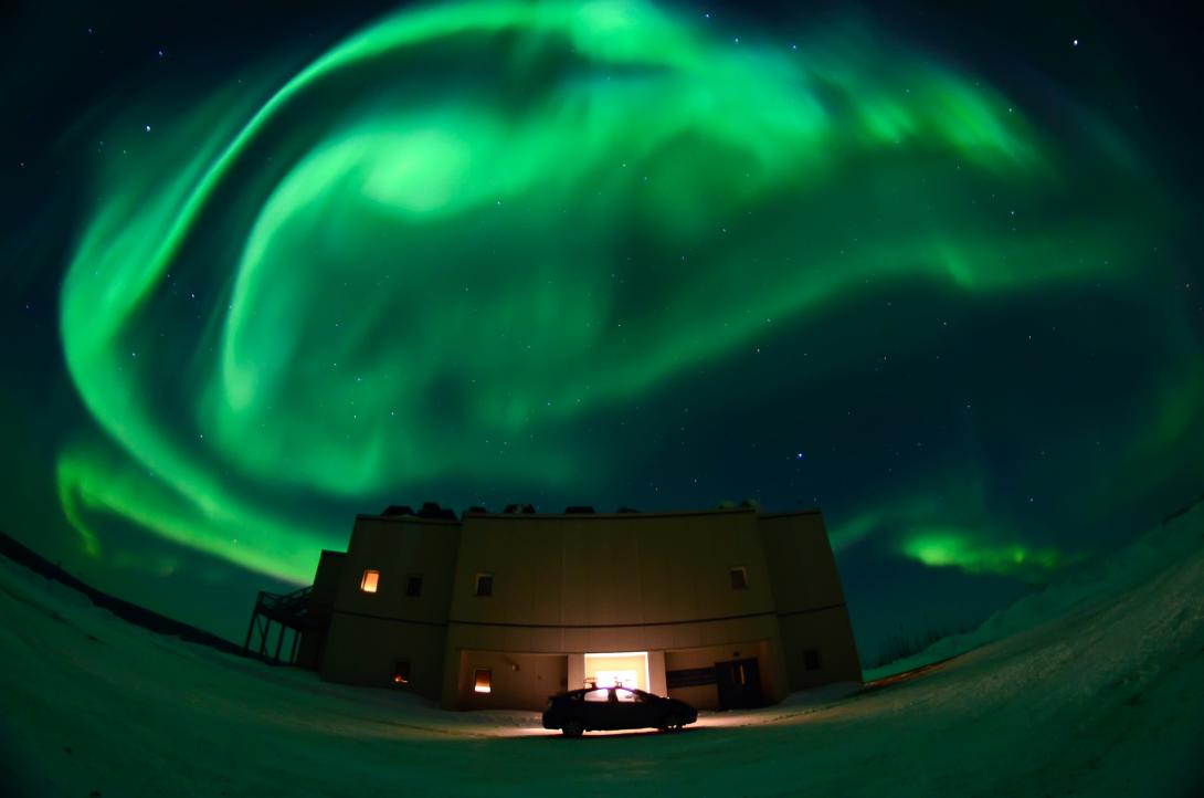
Aurora at the Poker Flat Science Operations Center. Photo taken by Jason Ahrns.
Aurora at the Poker Flat Science Operations Center. Photo taken by Jason Ahrns.
Sprite and faint airglow seen over Laramie Wyoming during Hans Nielsen/Geoff McHarg's 2014 sprite campaign. Photo taken by Jason Ahrns.
Auroras over McMurdo. Photo taken May 2014 at Arrival Heights, McMurdo Antarctica by Cao Chen.
Instruments and Landmarks Related to Space Physics
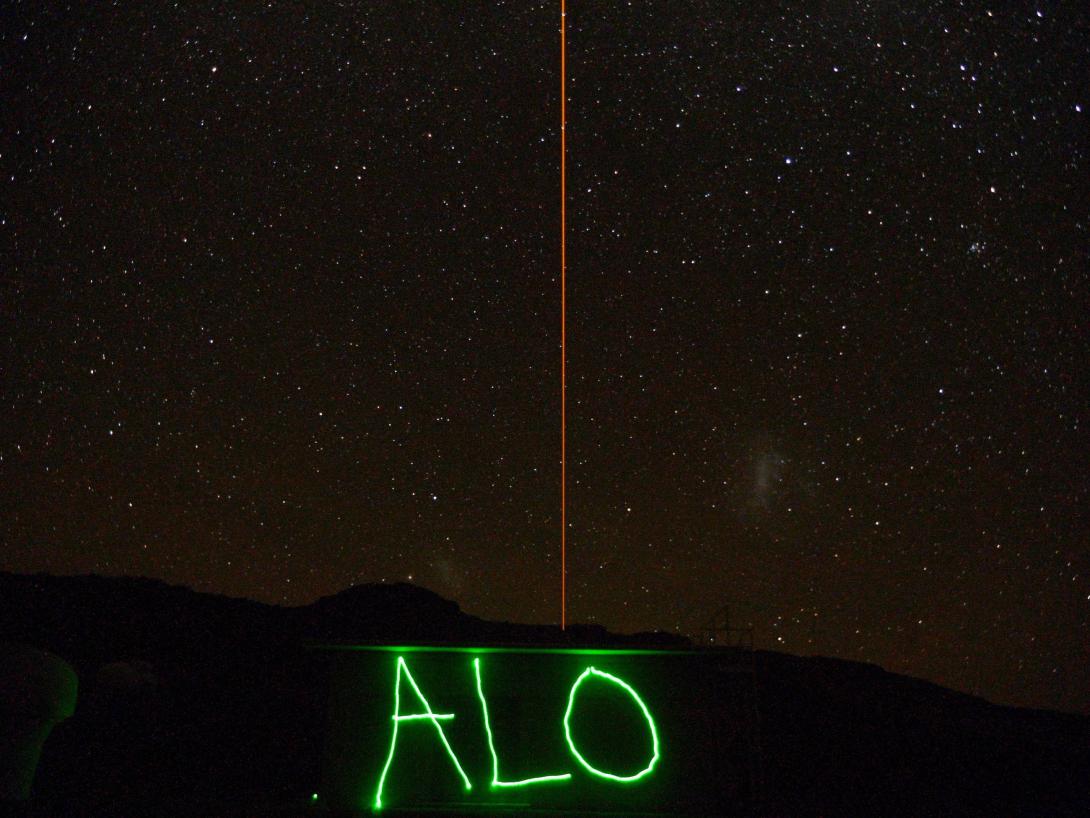
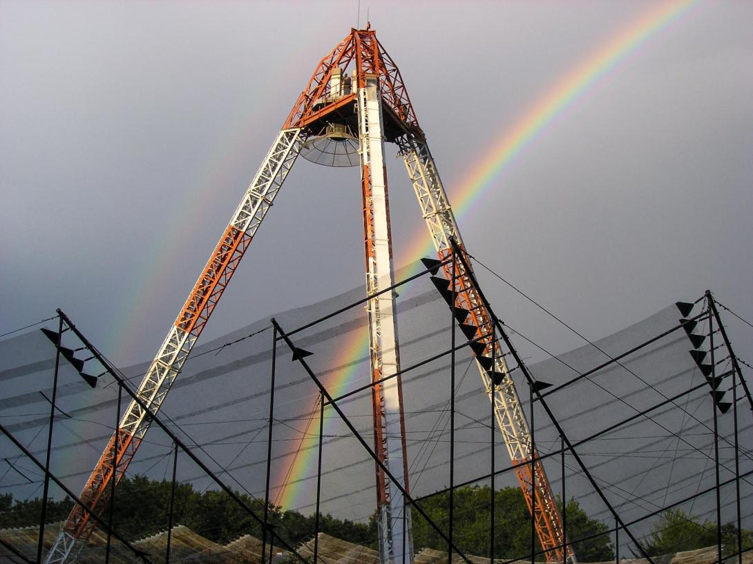
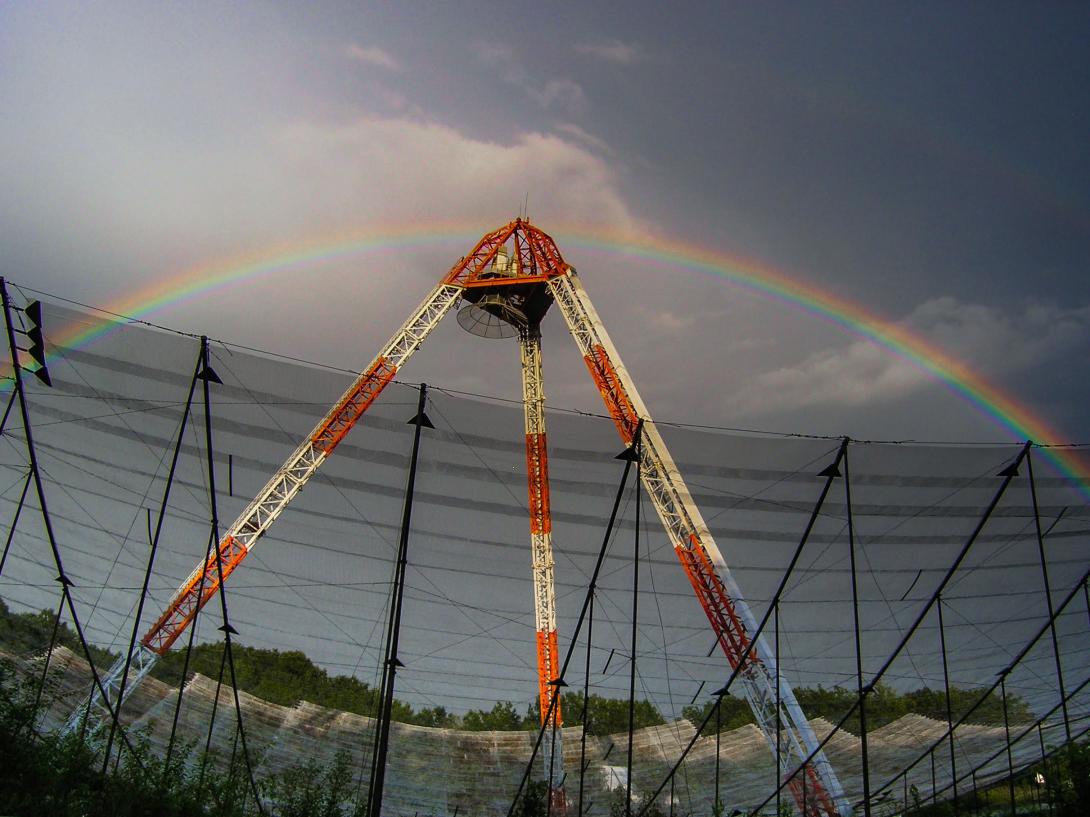
(2015 Photo Contest Winner) "This picture was taken at the Andes Lidar Observatory, located in Cerro Pachón, Chile (30S, 71W). The yellow Na laser is used to probe the upper mesosphere and lower thermosphere. I took the picture, while the “ALO” writing on the wall of the observatory was made by John Smith at U of Colorado at Boulder. The picture was taken on May 29, 2014." - Alan Liu
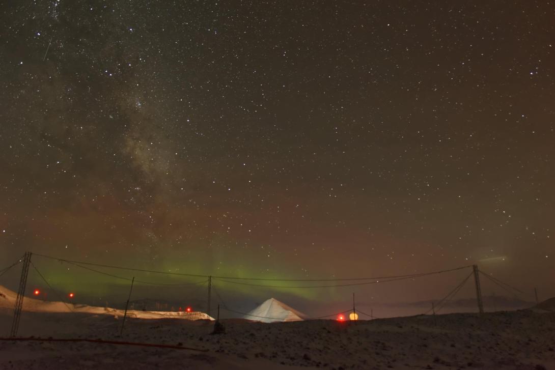
(2015 Photo Contest Honorable Mention) The McMurdo station in Antarctica during the winter with weak auroras in the background. Taken May 2014 by Cao Chen.
(2015 Photo Contest Honorable Mention) The Incoherent Scatter Radar at Millstone Hill, near Boston, MA. The radar program at MIT Haystack Observatory is supported by cooperative agreement between the National Science Foundation and the Massachusetts Institute of Technology. Taken in August 2008 by Dr. Shunrong Zhang
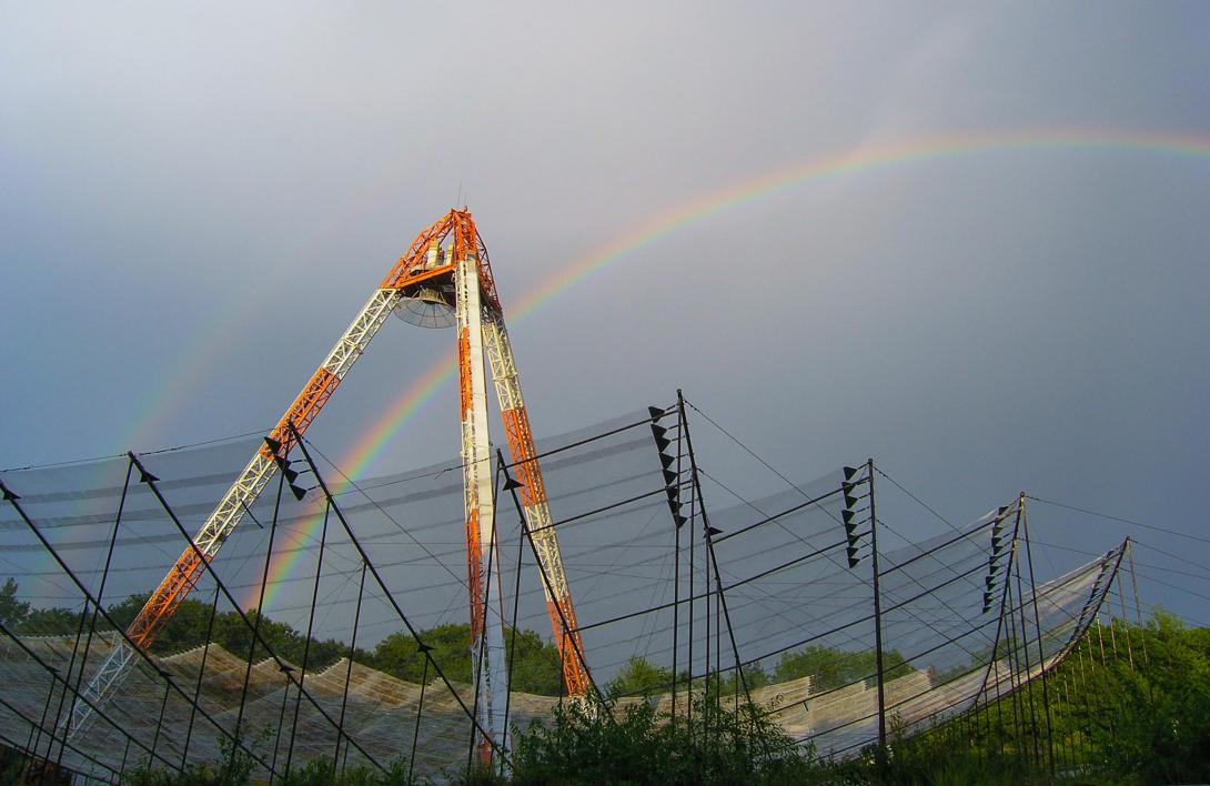
Svalbard EISCAT antenna. Photo taken by Jason Ahrns
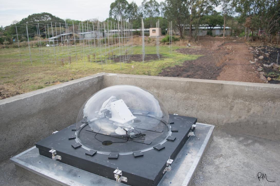
The Sky-Scanner from the top of the observatory's building at the Bahir Dar University, overlooking the antenna array. This is the only (and possibly the first) operational FPI system in the eastern African sector. Taken May 2015 by Rafael Mesquita.
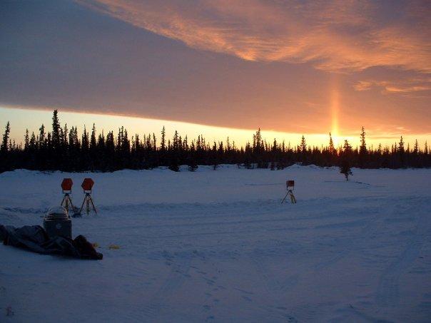
Imagers set up in Ft. Yukon, Alaska at sunset waiting for a sounding rocket launch window to open, with a sun pillar visible in the background. Taken early February 2010 by Carl Andersen.
The observatory in Kaktovik, Alaska, which houses a all-sky camera, meridian spectrograph, scanning doppler imager and magnetometer among other things. The Arctic Ocean is in the background, ~100 yards behind the observatory. Taken early June 2014 by Carl Andersen.
Taken 14 Nov 2014 by Manbharat Singh Dhadly at Ny-Alesund (world's northernmost village), during the C-REX rocket mission. Imagers are ready for capturing the ion-neutral dynamics in upper thermosphere and cusp region.
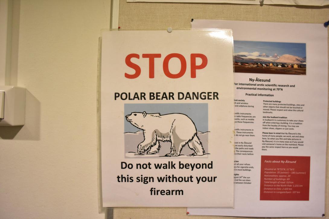
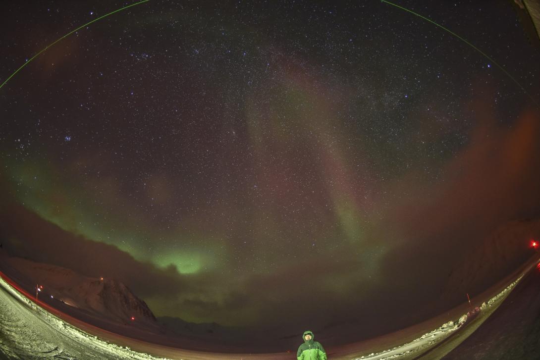
A polar bear warning taken 15 Nov 2014 by Manbharat Singh Dhadly at Ny-Alesund (world's northernmost village), during the C-REX rocket mission.
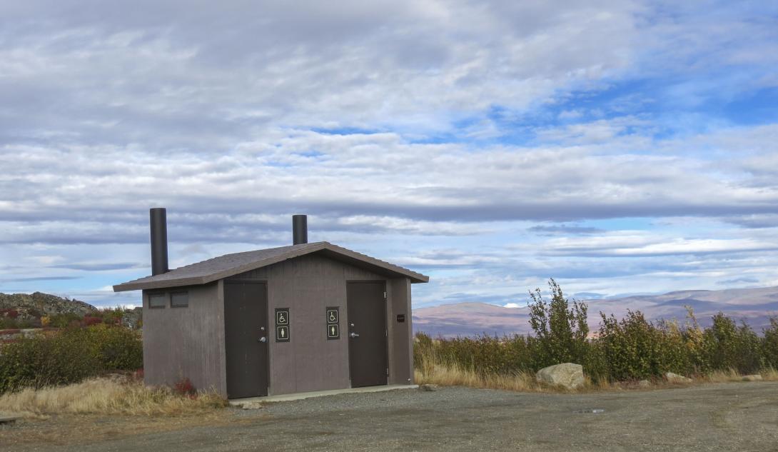
Restroom in Alaska with beautiful background. Taken September 2013 on the way to Toolik Field station to repair a Scanning Doppler Imager (SDI) by Manbharat Singh Dhadly
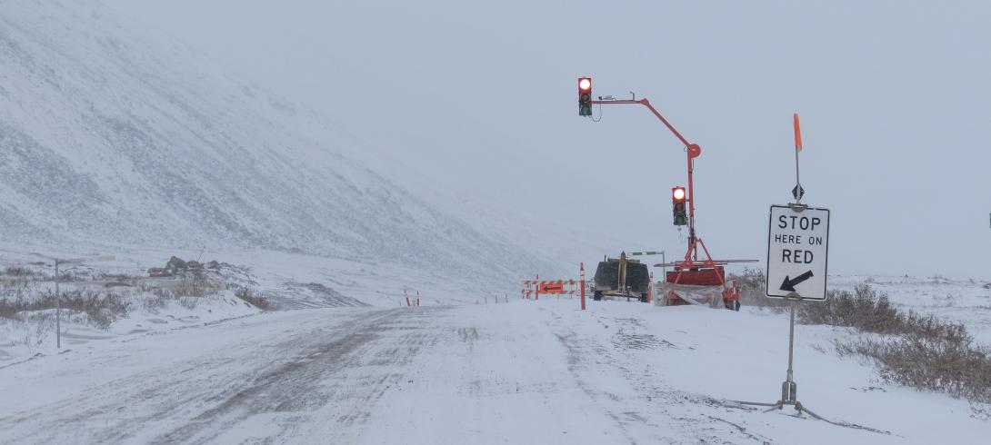
"We have traffic lights in Arctic...... to control wilderness :) " Taken November 2013 on the way to Toolik Field station to repair a Scanning Doppler Imager (SDI) by Manbharat Singh Dhadly
The Incoherent Scatter Radar at Millstone Hill, near Boston, MA. The radar program at MIT Haystack Observatory is supported by cooperative agreement between the National Science Foundation and the Massachusetts Institute of Technology. Taken in August 2008 by Dr. Shunrong Zhang.
The Incoherent Scatter Radar at Millstone Hill, near Boston, MA. The radar program at MIT Haystack Observatory is supported by cooperative agreement between the National Science Foundation and the Massachusetts Institute of Technology. Taken in August 2008 by Dr. Shunrong Zhang.
Jef Spaleta ensures that the poles of the McMurdo Station SuperDARN Radar are properly aligned. Taken 9 December 2014 by Nathaniel Frissell at the McMurdo SuperDARN Station.
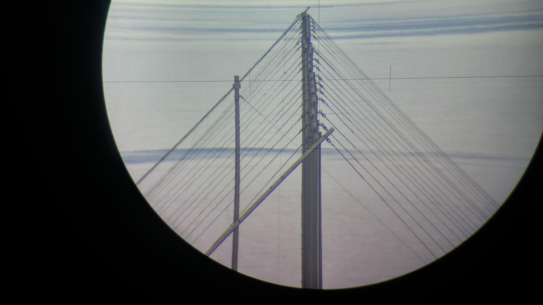
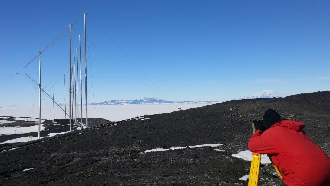
A view of the McMurdo Station SuperDARN Radar poles through the theodolite as viewed from the hill leading up to Arrival Heights. Taken 13 December 2014 by Nathaniel Frissell at the McMurdo SuperDARN Station.
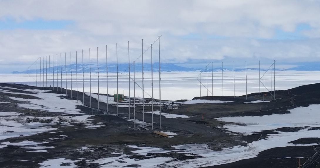
A view of the McMurdo Station SuperDARN. Taken 13 December 2014 by Nathaniel Frissell.
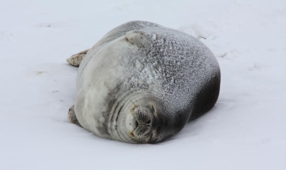
A Weddell seal lounging on the sea ice. Taken 17 December 2014 by Nathaniel Frissell at Pressure Ridges at Scott Base, Antarctica.
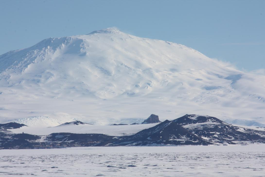
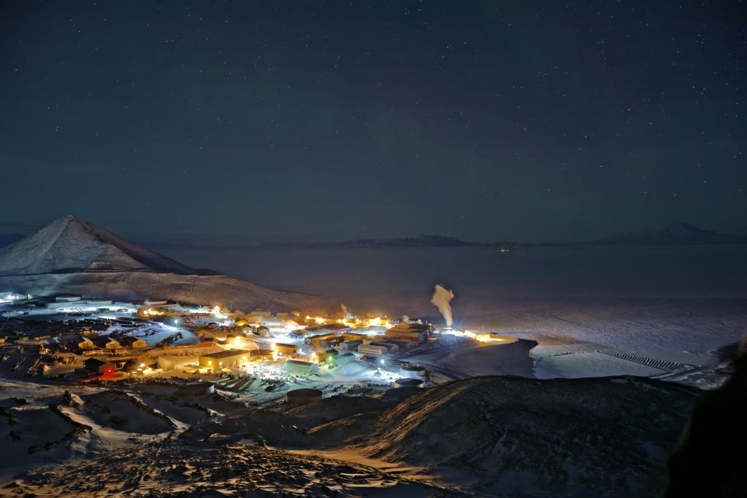
Mount Erebus (3,794 m / 12,448 ft) is the worlds southernmost active volcano and is located near McMurdo Station (US) and Scott Base (NZ) on Ross Island, Antarctica. Castle Rock (middle of photo) is a popular hiking destination for residents of the Ross Island research stations. Observation is seen below and to the right of Castle Rock. McMurdo Station is visible in the lower left. The McMurdo SuperDARN is adjacent to the radome located above McMurdo Station. Taken 17 December 2014 by Nathaniel Frissell at Pegasus Airfield, Antarctica.
People of the CEDAR Community

(2015 Photo Contest Winner) Poster judges: Diego Janches, Rick Doe, and Simon Shepherd. Taken at CEDAR 2008 by Barbara Emery.
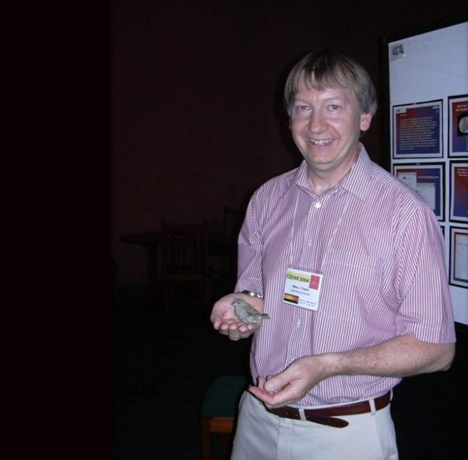
2015 Photo Contest Honorable Mention) Mike Taylor with a bird in the Pavilion poster room. Taken at CEDAR 2004 Barbara Emery.

(2015 Photo Contest Honorable Mention) "Girls in space physics!" Taken at CEDAR 2014 by Victoriya Forsythe
CEDAR student tutorial speaker Rod Heelis of UTD tells incoming CSSC chair Jan Sojka of USU what he can expect in his term. Taken at CEDAR 2005 by Barbara Emery.
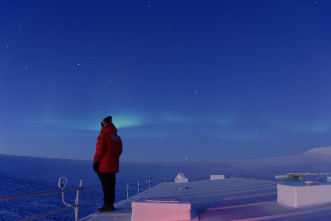
Taken May 2014 at Arrival Heights, McMurdo Antarctica by Cao Chen. The only winter-over scientist, shot while taking lidar data.
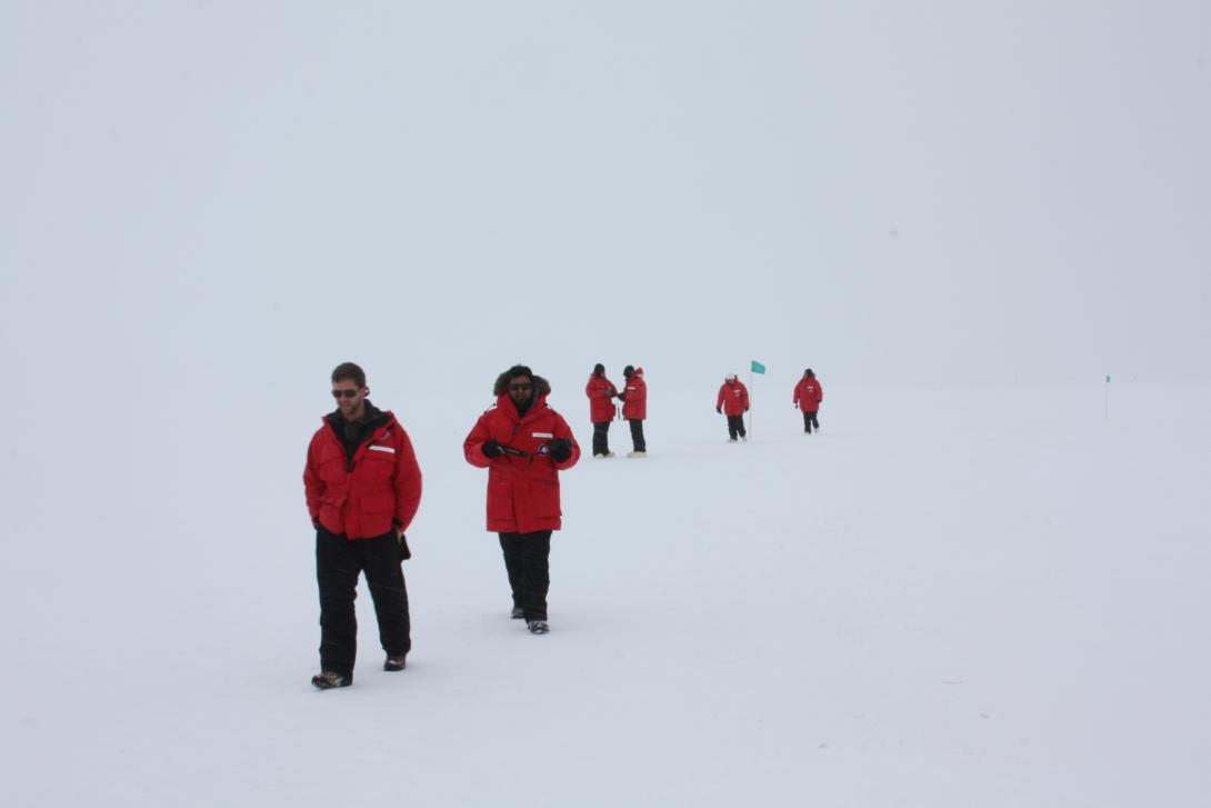
Scientists visit the Pressure Ridges at Scott Base, Antarctica, near the McMurdo Station SuperDARN Radar. Taken 17 December 2014 by Nathaniel Frissell at Pressure Ridges at Scott Base, Antarctica.